Walking Route Description
This description assumes you wish to get back to your car where you have left it at the beginning of the day – so they are from locations which contain a railway station.
Recommended OS map OS 301 Scarborough Bridlington and Flamborough Head
DAY 1: Bridlington Priory via St Oswald’s Flamborough to St Michael’s Bempton (distance 8.5 miles)
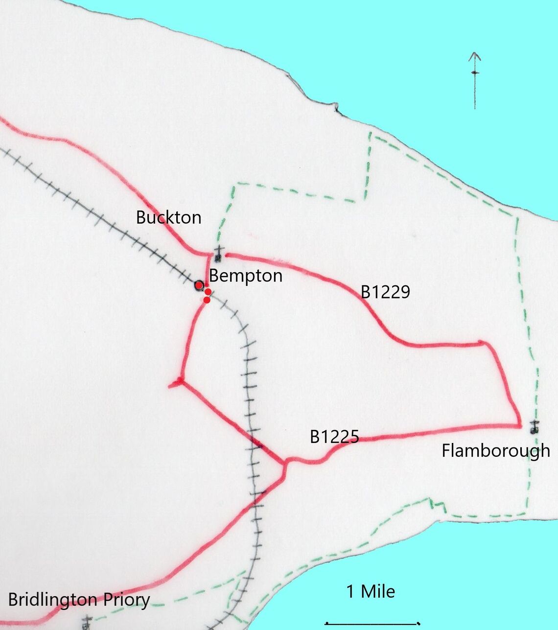
Walk about half a mile along the road on the north side of the Priory (Sewerby Road). Cross the roundabout, past Headlands School and take the first road on the right (Limekiln Lane). After the railway bridge turn left across a large grassy area to the cliff path. Follow this eastwards past Sewerby Hall until you get to Danes Dyke.
Turn left and continue until the steps descending to cross a bridge over a stream and ascending the other side. Toilets are found by turning right at the top – otherwise continue straight ahead along the road to the junction and take the right. This is a one-way system for cars which are going in the same direction as yourself but there is a footpath through the trees to your right. A few hundred yards further on there is a clearing to your right with a path across the fields. The footpath leads to Flamborough village. You can see the church as you approach.
After visiting the St Oswald’s church leave through the north gate, turn right and go along the main road (care needed to cross) to the main cross roads by the fisherman’s Memorial. Go straight across here into Woodcock Road until the road begins to bend to the right near a building site. There is a path on this bend (left hand side of the road). The path here leads to North Cliff and the coastal path once again.
Follow the coastal path for just over a mile. Here there is a kissing gate leading to a concessionary path across three fields. Turn right at the final kissing gate and walk ahead for another mile, ignoring the first turning left. At the end of the lane you are on Cliff Lane. Turn left and go towards the village. You will see St Michael’s church ahead across High Street.
Bempton railway station is found by walking south along the road.
DAY 2: St Michael’s Bempton to St Oswald’s Filey (distance 10 miles)
Please check tide times for this route – it is impassable at high tide and can be dangerous if you get caught by the rising tide.
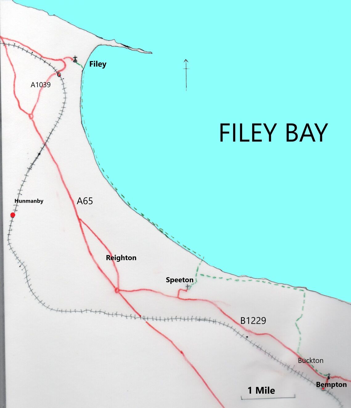
Return to High Street and turn left to walk west through Bempton and Buckton until you come to the end of Buckton by the duck pond. Turn left here and follow Hoddy Cows Lane for a mile to the cliff path and turn left.
Follow the cliff path for about 2 miles until you come to a junction with kissing gates. Turn uphill and walk for about half a mile to find St Leonard’s Speeton.
After visiting St Leonard’s retrace your steps to the junction and continue downhill to the cliff edge and turn left. Follow this path for a few yards to reach steps going down to the beach below. Turn left and walk along the sand to Filey for 4.5 miles until you reach the lifeboat station.
Turn left just before the lifeboat station and ascend the steps on your right just past the (toilets on your left). Turning left at the top you will see St Oswald’s church ahead.
Filey railway station is to the west of the town centre on the left of the A1039
near to Tesco.
DAY 3: St Oswald’s Filey to St Mary’s Scarborough (distance 10 miles)
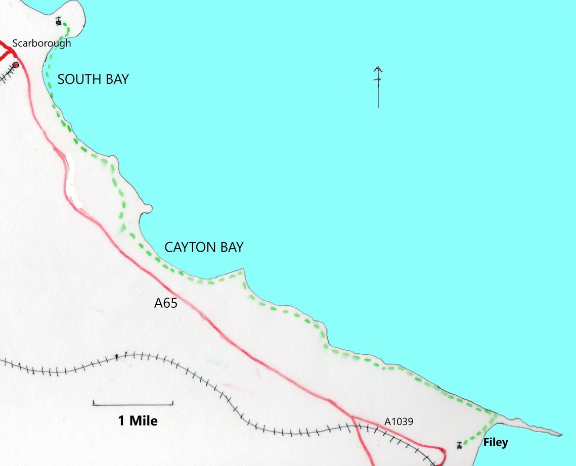
From St Oswald’s retrace your steps as far as the top of the steps and then turn across the grass northwards through the car park of the country park. Carry on in the same directions to reach the monument for the junction of the Wolds Way and the Cleveland Way. Continue along the Cleveland Way to Cayton Bay (shop and toilets).
The Way goes across a field and then a finger post indicates it goes steeply downwards. Ignore this and continue straight ahead along the old road until the end of the houses and a footpath leads you down to the right to rejoin the Cleveland Way on your left.
At the Holbeck car park walk through the car park, along Sea Cliff Road to the end. Turn right along that road a bit, right again and on to the long road on the top with municipal gardens on your right until you come to Dulverton Hall on your left. There is a path leading down and left through the gardens to St Nicholas Bridge and the Grand Hotel.
Walk along St Nicholas Street to Eastborough and turn right at the market hall. Go around 2 sides of the hall into Friargate and then Tollergate, right into St Mary’s Walk. St Mary’s church is easily visible.
Scarborough railway station is in the centre of the town and found by walking west along Westborough.